


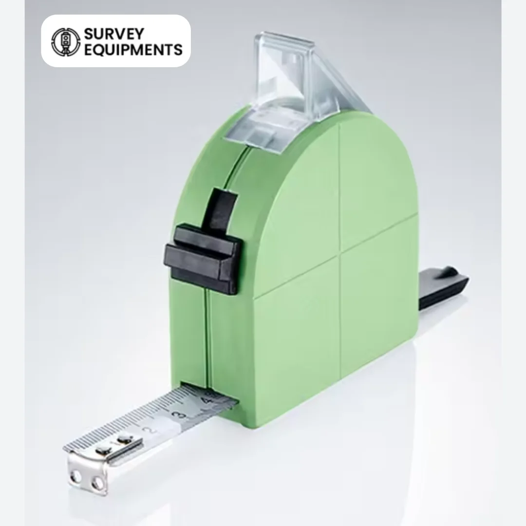
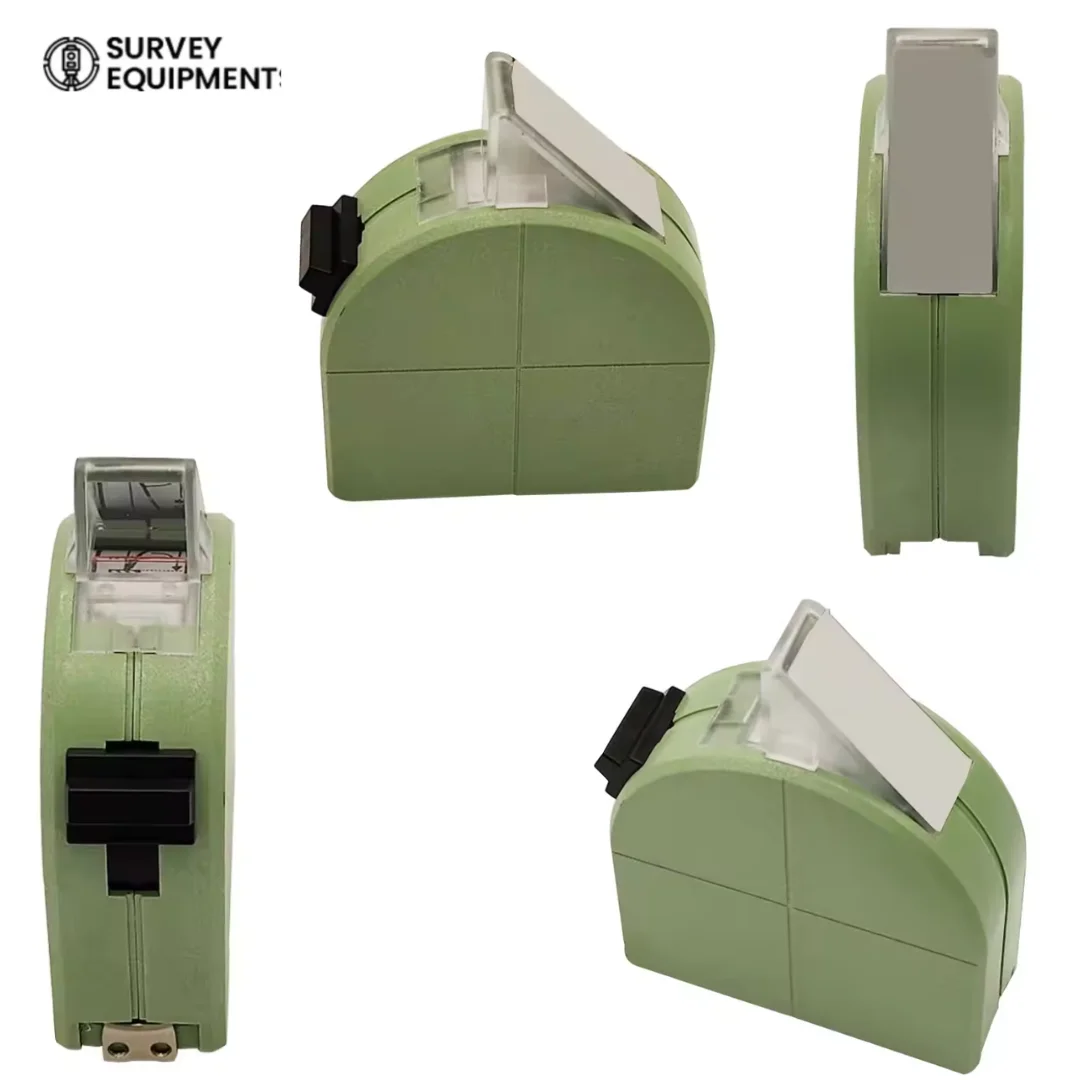



The Leica GHM007 Instrument Height Meter (667718) is a precision surveying accessory designed to measure instrument height quickly and accurately for Leica total stations and GNSS receivers. It helps surveyors obtain consistent height measurements, improving field accuracy, reducing manual errors, and streamlining surveying workflows.
The Leica GHM007 Instrument Height Meter is an essential tool for professional land surveyors, construction engineers, mapping specialists, and geospatial professionals. Designed specifically for Leica surveying equipment, it provides a reliable method for determining the instrument height required during total station and GNSS survey setup.
Whether you’re performing topographic surveys, construction layout, control point establishment, or infrastructure projects, the GHM007 delivers repeatable and dependable measurements that contribute to accurate survey results.
Technical Specifications
| Specification | Details |
| Product Name | Leica GHM007 Instrument Height Meter |
| Model | GHM007 |
| Part Number | 667718 |
| Product Type | Instrument Height Meter |
| Brand | Leica Geosystems |
| Compatible Equipment | Leica Total Stations and Leica GNSS Survey Equipment |
| Measurement Purpose | Instrument Height Measurement |
| Application | Professional Surveying |
| Construction | Durable Field-Use Design |
| Portability | Lightweight and Compact |
Key Benefits of the Leica GHM007 Height Meter
- Provides fast and accurate instrument height measurement
- Designed for Leica Total Stations and Leica GNSS survey equipment
- Reduces human error during instrument setup
- Improves surveying efficiency in the field
- Durable construction suitable for demanding outdoor environments
- Lightweight and portable for daily field use
- Professional surveying accessory for precise data collection
- Helps maintain measurement consistency across survey projects
Features of Leica GHM007 Instrument Height Meter
Precision Instrument Height Measurement
Designed to simplify instrument height determination while improving measurement consistency for surveying applications.
Leica Survey Equipment Accessory
Engineered to integrate with Leica surveying systems, making it a valuable addition to professional survey kits.
Rugged Field Construction
Manufactured using durable materials to withstand frequent transport and challenging outdoor job site conditions.
Lightweight and Portable
Compact design makes it easy to carry alongside total stations, GNSS receivers, tribrachs, prisms, and other survey accessories.
Professional Surveying Tool
Ideal for daily use by surveyors who require repeatable and accurate instrument height measurements.
Applications
The Leica GHM007 Instrument Height Meter is suitable for:
- Land surveying
- Construction surveying
- Engineering surveys
- Topographic mapping
- Boundary surveys
- Road construction
- Railway surveying
- Mining surveys
- Utility surveys
- Infrastructure development
- GNSS control surveys
- Total station setup
- Geospatial data collection
Why Choose the Leica GHM007 Instrument Height Meter?
Professional surveying depends on precise instrument setup. The Leica GHM007 helps surveyors measure instrument height accurately and consistently, reducing setup time while improving confidence in collected survey data.
Its practical design makes it an indispensable accessory for Leica total stations and GNSS receivers used in demanding field environments.
What’s Included
- Leica GHM007 Instrument Height Meter
- Protective packaging
Frequently Asked Questions
What is the Leica GHM007 Instrument Height Meter used for?
The Leica GHM007 is used to accurately measure the height of Leica surveying instruments during total station and GNSS field setup.
Which surveying equipment is compatible with the Leica GHM007?
It is designed for use with Leica Total Stations and Leica GNSS survey equipment that support instrument height measurement using the appropriate mounting accessories.
Why is accurate instrument height important?
Accurate instrument height ensures reliable survey calculations, minimizes measurement errors, and improves the overall accuracy of surveying and mapping projects.
Is the Leica GHM007 suitable for construction surveying?
Yes. It is widely used in construction layout, engineering surveys, infrastructure projects, and professional land surveying.
Can the Leica GHM007 be used for GNSS surveys?
Yes. The GHM007 is suitable for GNSS survey applications where accurate instrument height measurement is required.
Is this a portable surveying accessory?
Yes. Its lightweight and compact design allows surveyors to transport and use it conveniently in daily field operations.






Reviews
There are no reviews yet.