


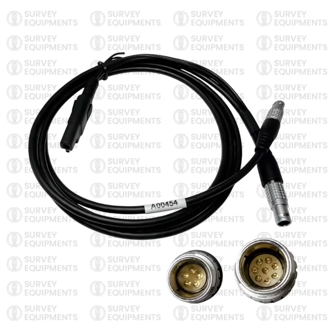




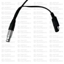


A00454 GPS PDL Power Cable Y-Type is a professional-grade connectivity solution designed specifically for surveying and geospatial equipment users who rely on precision, stability, and uninterrupted data transmission. This specialized cable is used to connect Leica GPS systems (including GPS 1230 and similar models) to Pacific Crest PDL HPB radios, ensuring seamless communication and reliable power/data transfer between devices in demanding field environments.
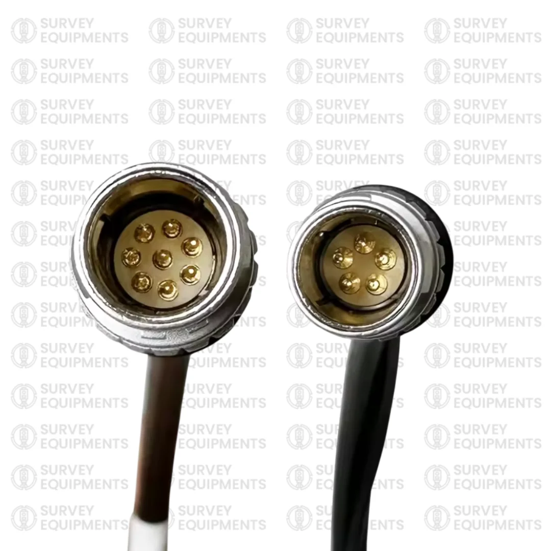
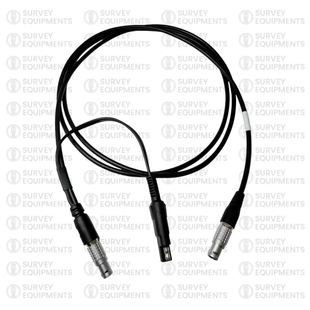
Built with durability, compatibility, and performance, the A00454 cable features a 5-pin to 8-pin Y-type configuration, making it an essential accessory for surveyors, engineers, GIS professionals, and construction teams who depend on Leica and Pacific Crest systems for accurate positioning and data collection.
In modern surveying workflows, even the smallest interruption in signal or power can lead to delays, inaccuracies, or data loss. That is why choosing a high-quality, purpose-built cable like the A00454 GPS PDL Power Cable for Leica GPS to Pacific Crest PDL HPB is critical for professional reliability.
What is the A00454 GPS PDL Power Cable?
The A00454 GPS PDL Power Cable is a specialized interface cable designed to link Leica GPS receivers with Pacific Crest PDL HPB radio modems. It acts as both a power delivery cable and a data communication bridge, enabling real-time GNSS corrections and stable connectivity between surveying equipment.
This cable is commonly used in:
- Leica GPS 1230 systems
- Leica GPS 1200 series and compatible GNSS receivers
- Pacific Crest PDL HPB radios
- Survey-grade base and rover setups
- RTK (Real-Time Kinematic) GNSS configurations
The Y-type structure allows the cable to split or manage connections efficiently, ensuring that both power and signal lines are properly routed without interference.
Key Features of A00454 GPS PDL Power Cable
The A00454 GPS PDL Power Cable for Leica GPS to Pacific Crest PDL HPB stands out due to its professional-grade construction and compatibility features.
1. Precise Compatibility
Designed specifically for Leica and Pacific Crest systems, this cable ensures flawless integration with:
- Leica GPS 1230
- Leica GNSS receivers
- Pacific Crest PDL HPB radios
- Surveying base stations and rover setups
2. 5-Pin to 8-Pin Y-Type Configuration
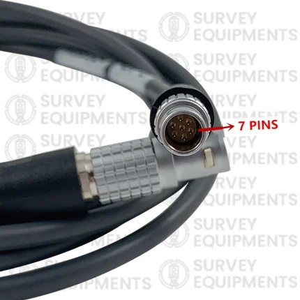
The cable features a 5-pin Leica connector and an 8-pin Pacific Crest connector, ensuring correct signal alignment and secure communication between devices.
3. Reliable Data Transmission
Engineered for high-accuracy surveying environments, it supports stable data transfer for:
- RTK corrections
- GNSS positioning data
- Real-time field communication
4. Durable Construction
Built with rugged materials, the cable is designed to withstand:
- Harsh outdoor conditions
- Dust and moisture exposure
- Continuous field use
- Temperature variations
5. Flexible Y-Type Design
The Y-type structure allows efficient routing of power and data lines, minimizing cable clutter and improving field setup organization.
6. Plug-and-Play Operation
No complex configuration is required. Simply connect and begin using your surveying equipment instantly.
Applications of A00454 GPS PDL Power Cable
The A00454 GPS PDL Power Cable is widely used across multiple industries that depend on high-precision location data.
1. Land Surveying
Surveyors rely on this cable to connect GNSS receivers with radio modems for real-time corrections, ensuring centimeter-level accuracy.
2. Construction Projects
Used in construction layout, site mapping, and infrastructure development where precise positioning is critical.
3. GIS and Mapping
Supports Geographic Information System (GIS) professionals in collecting accurate spatial data.
4. Engineering Surveys
Ideal for civil, structural, and transportation engineering projects requiring reliable GNSS communication.
5. RTK Base and Rover Setup
Essential for Real-Time Kinematic setups where continuous correction signals are needed.
Why Choose A00454 GPS PDL Power Cable?
Choosing the right cable is not just about compatibility—it is about performance, reliability, and long-term durability.
1. Ensures Stable Communication
The cable minimizes signal loss and ensures stable communication between Leica GPS systems and Pacific Crest radios.
2. Reduces Field Downtime
A reliable cable prevents interruptions, helping survey teams maintain productivity.
3. Professional-Grade Performance
Designed for survey-grade equipment, it meets the demands of professional users.
4. Enhanced Durability
Built to last in tough outdoor environments, reducing replacement frequency.
5. Accurate Data Transfer
Supports precise GNSS data transmission, critical for RTK surveying accuracy.
Technical Specifications of A00454 GPS PDL Power Cable
| Specification | Details |
| Product Name | A00454 GPS PDL Power Cable |
| Connector Type | 5-Pin (Leica GPS) to 8-Pin (Pacific Crest PDL HPB) |
| Cable Type | Y-Type Power and Data Cable |
| Compatibility | Leica GPS 1230, Leica GNSS series, Pacific Crest PDL HPB |
| Function | Power supply + data communication |
| Usage | Surveying, RTK GNSS, GIS, construction |
| Design | Rugged outdoor-grade construction |
Compatibility Overview
The A00454 GPS PDL Power Cable for Leica GPS to Pacific Crest PDL HPB is compatible with a wide range of professional surveying devices.
Leica Systems Compatibility:
- Leica GPS 1230
- Leica GPS 1200 series
- Leica GNSS receivers
- Leica base and rover systems
Pacific Crest Compatibility:
- PDL HPB radio modems
- Pacific Crest data link systems
- RTK correction modules
This wide compatibility makes it a versatile solution for survey professionals using mixed equipment systems.
Installation and Usage Guide
Using the A00454 GPS PDL Power Cable is straightforward and does not require technical expertise.
Step 1: Identify Ports
Locate the 5-pin port on Leica GPS receiver and the 8-pin port on Pacific Crest PDL HPB radio.
Step 2: Connect Cable Ends
Attach each connector securely into the corresponding device port.
Step 3: Power On Devices
Turn on both the GPS receiver and radio modem.
Step 4: Verify Connection
Check for successful signal transmission or RTK correction status.
Step 5: Begin Surveying
Once connected, begin collecting GNSS data or performing surveying tasks.
Benefits of Using A00454 GPS PDL Power Cable
Improved Workflow Efficiency
Reduces setup time and improves field productivity.
High Accuracy Data Transfer
Ensures GNSS corrections are transmitted without delay.
Long-Term Reliability
Built to withstand repeated field usage.
Reduced Equipment Downtime
Minimizes connection failures and technical interruptions.
Cost-Effective Solution
Prevents frequent replacement and reduces operational costs.
Maintenance Tips for A00454 GPS PDL Power Cable
To extend the lifespan of your cable:
- Avoid excessive bending or twisting
- Store in a dry, clean environment
- Keep connectors free from dust and moisture
- Inspect regularly for wear and tear
- Use protective casing during transportation
Proper maintenance ensures long-term performance and reliability in field conditions.
Frequently Asked Questions
What is the A00454 GPS PDL Power Cable used for?
The A00454 GPS PDL Power Cable is used to connect Leica GPS receivers to Pacific Crest PDL HPB radios for power and data communication in surveying applications.
Which devices are compatible with this cable?
It is compatible with Leica GPS 1230, Leica GNSS systems, and Pacific Crest PDL HPB radio modems.
What type of connectors does it have?
It features a 5-pin Leica connector and an 8-pin Pacific Crest connector in a Y-type configuration.
Is this cable suitable for RTK surveying?
Yes, it is specifically designed for RTK GNSS setups requiring real-time correction data transmission.
Can it be used in outdoor environments?
Yes, it is built for rugged outdoor use and can withstand harsh field conditions.
Does it require any software setup?
No, the cable is plug-and-play and does not require software installation.
What makes the Y-type design important?
The Y-type design allows efficient separation of power and data lines, improving connection stability and reducing interference.
Is it suitable for GIS applications?
Yes, it is widely used in GIS mapping and geospatial data collection workflows.






Reviews
There are no reviews yet.