



Experience unmatched accuracy and performance with the Livox TELE-15 LiDAR, a next-generation long-range laser sensor engineered for advanced surveying, industrial automation, and 3D mapping applications. Combining Livox’s proprietary scanning technology, durable build, and intelligent algorithms, the TELE-15 sets a new benchmark in long-distance detection and precision-based mapping.
This LiDAR system is purpose-built for professionals who demand consistent reliability, millimeter-grade precision, and efficient data acquisition all within a compact and affordable solution.
Overview : Redefining Long-Range LiDAR Performance
The Livox TELE-15 LiDAR sensor is designed for environments where accuracy, range, and performance are non-negotiable. Built with advanced aluminium-copper alloy housing and FR-4 electronic substrate, this industrial-grade sensor delivers durability without compromising precision.
With a detection range of up to 500 meters and accuracy within 2 centimeters, the TELE-15 ensures every point cloud it generates reflects true-to-life spatial data — critical for topographic mapping, drone-based surveying, autonomous navigation, and infrastructure inspection.
Unlike conventional mechanical LiDARs, Livox integrates non-repetitive scanning technology, offering a dense, uniform point cloud over time. This enables seamless integration into autonomous systems, mobile mapping platforms, and industrial robots that rely on dependable 3D perception.
Key Features of the Livox TELE-15 LiDAR
Extended Detection Range (Up to 500 Meters)
The Livox TELE-15 long-range LiDAR excels in capturing distant objects with high fidelity. Whether mounted on UAVs, vehicles, or tripods, it ensures exceptional performance even in challenging terrain.
- Detection range: 320 m @10% reflectivity, 500 m @50% reflectivity
- Precision: ±2 cm (1σ @ 20 m)
- Wavelength: 905 nm laser
This capability makes it ideal for large-scale mapping, terrain modeling, roadway analysis, and industrial monitoring.
High-Precision Point Cloud Generation
Accuracy defines the success of any surveying project. The TELE-15 delivers sub-centimeter precision with up to 480,000 points per second (dual return). Its low-latency scanning (≤2 ms) ensures smoother, more stable point cloud generation, crucial for dynamic applications like drone surveys and vehicle navigation.
This level of detail enables engineers and surveyors to build high-resolution 3D models, ensuring precise volume calculations, elevation profiles, and environmental assessments.
Compact, Rugged, and Reliable Design
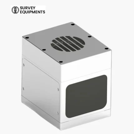
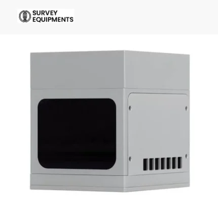
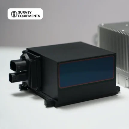
Constructed from aluminium-copper alloy, the TELE-15 LiDAR sensor combines structural rigidity with efficient heat dissipation. The IP67 protection rating ensures reliable operation in dusty, humid, or rainy conditions, while the FR-4 circuit substrate enhances durability and performance stability.
The robust enclosure and shock-resistant mounting make it suitable for aerial drones, ground vehicles, and industrial equipment deployed in the field.
Advanced Non-Repetitive Scanning Pattern
Unlike traditional spinning LiDARs that follow predictable paths, the TELE-15 uses Livox’s proprietary non-repetitive scanning pattern. This allows for a more uniform and complete field of view coverage, significantly improving data quality for 3D perception and mapping.
The result is a richer and denser point cloud ideal for machine vision, autonomous driving, and precision agriculture.
Flexible Integration and Industrial Compatibility
The Livox TELE-15 LiDAR is designed for easy integration with multiple hardware and software ecosystems. It supports various output interfaces and SDKs for developers, making it suitable for:
- UAV and drone mapping systems
- Autonomous vehicles and robotics
- GIS and 3D modeling software
- Industrial automation platforms
- Smart infrastructure projects
Whether connected through Ethernet or integrated via Livox SDK, the TELE-15 offers broad compatibility with major operating systems and mapping suites.
Low Power Consumption and Efficient Performance
Power efficiency is crucial for drone-based or mobile applications. The TELE-15’s optimized circuitry and energy-efficient scanning mechanism minimize heat generation and extend operational life. This allows professionals to achieve longer flight times and extended field missions without performance compromise.
Applications of Livox TELE-15 LiDAR
Land Surveying & Topographic Mapping
Capture detailed 3D terrain models and elevation data with precision. The TELE-15 ensures survey-grade results in construction planning, mining, and infrastructure development projects.
Drone-Based Aerial Mapping
Its lightweight build and long-range detection make the TELE-15 a preferred choice for UAV-mounted LiDAR systems, providing accurate terrain and vegetation mapping for agriculture, forestry, and environmental studies.
Autonomous Navigation and Robotics
Enhance obstacle detection, localization, and environment perception for autonomous vehicles and mobile robots. The TELE-15 enables safe navigation in both indoor and outdoor environments.
Smart City & Infrastructure Monitoring
From traffic flow analysis to bridge and tunnel inspection, this industrial LiDAR scanner offers accurate data for smart city infrastructure management.
Industrial Automation & Robotics
Used in robotic arms, industrial inspection systems, and automation lines, the TELE-15 delivers precise spatial sensing for positioning, calibration, and machine guidance.
Technical Specifications
| Specification | Livox TELE-15 LiDAR |
| Model Number | TELE-15 |
| Brand Name | Livox |
| Detection Range | Up to 500 m (50% reflectivity) |
| Range Precision | ±2 cm (1σ @ 20 m) |
| Laser Wavelength | 905 nm |
| Point Rate | Up to 480k pts/s (dual return) |
| Field of View (FOV) | 15° (H) × 15° (V) |
| Scan Pattern | Non-repetitive scanning |
| Protection Level | IP67 |
| Material | Aluminium-copper alloy, FR-4 board |
| Weight | ~905 g |
| Power Consumption | 12 W typical |
| Operating Temperature | −20°C to +65°C |
| Interface | Ethernet |
| Package | Suitable Carton Box |
Why Choose the Livox TELE-15 LiDAR?
- Professional-grade accuracy: ±2 cm precision for detailed measurements
- Long detection distance: 500 m range ideal for extensive mapping areas
- Compact and lightweight: Ideal for drones and mobile survey platforms
- Rugged construction: IP67 waterproof, dustproof, and vibration-resistant
- Livox reliability: Engineered for consistent, repeatable results in industrial environments
- Easy software integration: SDKs, APIs, and data output compatibility with major mapping platforms
The Livox TELE-15 not only matches the performance of traditional spinning LiDARs but also outperforms them in cost efficiency and reliability.
Product Advantages Compared to Other LiDARs
| Feature | Livox TELE-15 | Traditional LiDARs |
| Scanning Type | Non-repetitive | Mechanical rotating |
| Field of View Coverage | Uniform over time | Limited by rotation |
| Data Density | High | Moderate |
| Power Efficiency | Optimized | Higher consumption |
| Durability | IP67 industrial build | Often unsealed |
| Cost-Performance Ratio | Excellent | Expensive |
The Livox TELE-15 mapping sensor delivers the perfect balance of affordability, efficiency, and performance ideal for modern surveying workflows.
How the TELE-15 Enhances Surveying Productivity
By combining high precision and long-range capability, the Livox TELE-15 LiDAR enables surveyors to cover larger areas in less time while maintaining data integrity.
It integrates seamlessly with drone LiDAR mapping systems, reducing flight time per area surveyed, and minimizing data stitching errors. The sensor’s dense, uniform point clouds allow smoother surface reconstruction and more accurate elevation data models.
Whether used for urban mapping, pipeline inspection, or powerline monitoring, the TELE-15 accelerates project completion and reduces total cost per survey.
Installation and Integration Tips
- Mount securely using vibration-damping brackets for drone or vehicle installation.
- Calibrate using Livox Viewer software for optimal point cloud alignment.
- Ensure power supply meets rated specifications (12–24V DC).
- Use Gigabit Ethernet for fast data transfer and low latency performance.
- For 3D mapping, pair with GNSS/IMU systems for precise georeferencing.
Environmental and Operational Reliability
With its IP67 rating, the TELE-15 withstands dust, water jets, and vibration. The aluminium-copper alloy housing prevents corrosion, while internal thermal regulation ensures consistent output in temperature extremes from −20°C to +65°C.
Its industrial FR-4 board design enhances resistance to electromagnetic interference — crucial for operation near power lines, construction equipment, or heavy machinery.
Ideal Use Cases
- Topographic surveying for construction and civil engineering
- Forestry management for canopy height and biomass analysis
- Coastal and floodplain mapping for hydrology projects
- Highway and railway design surveys
- Powerline and utility inspection
- Autonomous navigation system integration
- Industrial plant monitoring and safety analysis
Frequently Asked Questions
What is the maximum range of the Livox TELE-15 LiDAR?
The TELE-15 LiDAR can detect objects up to 500 meters away (50% reflectivity) and 320 meters at 10% reflectivity, making it suitable for long-distance mapping and surveying applications.
Can I use the TELE-15 on drones or UAVs?
Yes. Its lightweight build and low power consumption make it ideal for drone-based LiDAR mapping missions, delivering precise elevation data and 3D terrain models.
What is the precision or accuracy level of this LiDAR sensor?
The Livox TELE-15 offers a range precision of ±2 cm (1σ @ 20 m), ensuring highly accurate point cloud data for professional surveying.
Does it support dual return point clouds?
Yes, the TELE-15 supports dual return mode, allowing it to detect objects through vegetation and semi-transparent surfaces ideal for forestry and urban mapping.
Is the Livox TELE-15 weather-resistant?
Absolutely. It comes with an IP67 protection rating, meaning it’s dust-tight and resistant to temporary water immersion, perfect for outdoor operations.
How does the TELE-15 differ from Livox Mid-40 or Horizon?
While the Livox Mid-40 and Horizon focus on medium-range scanning, the TELE-15 is optimized for long-range detection (up to 500m) with a narrower FOV, making it the preferred choice for long-distance applications.
What software can process Livox TELE-15 LiDAR data?
You can use Livox Viewer, Livox SDK, or integrate with ROS (Robot Operating System), Pix4D, DroneDeploy, CloudCompare, and other 3D mapping platforms.
What is the field of view (FOV) of the TELE-15?
The TELE-15 features a 15° horizontal × 15° vertical field of view, ideal for focused long-distance scanning and object detection.
What materials are used in its construction?
The housing is made from aluminium-copper alloy for durability, while the internal board is built from FR-4 material, ensuring stability and heat resistance.
Is there a warranty or technical support available?
Yes, every Livox TELE-15 LiDAR includes an official manufacturer warranty and access to Livox technical support for setup, calibration, and troubleshooting.




Reviews
There are no reviews yet.